Water kind of hides a lot of stuff. A seabed can have slopes, rocks, mud, old structures, pipes, and even deeper pockets in there. Before any marine work begins, you really want a clear picture of what is sitting under the water, not later, not after you have already started digging. That’s why Hydrographic Survey Services British Columbia helps project owners, ports, builders, and coastal crews make safer decisions.
A hydrographic survey basically measures water depth, and it also maps the underwater ground. This kind of info supports planning docks, dredging, pipelines, bridge work, marine construction, and routine coastal checks. Without that data, your project starts on guesswork. Guesswork costs time and money, even if you don’t notice it right away.
British Columbia has long coastlines, deep inlets, rivers, ports, and busy marine lanes. Every site has its own layout under the water, and it’s never exactly the same. A solid survey gives your team accurate data before work starts, so you spot risks early. You also reduce delays, and you end up planning with more control than before.
What Is a Hydrographic Survey?
A hydrographic survey is a water mapping job. Survey teams measure depth, seabed shape, shoreline details, and underwater features. The data shows how the bottom of a river, lake, harbour, or ocean area looks.
Think of it like making a map of land, but the land sits under water. The survey boat moves across the area. Sonar sends sound pulses down to the bottom. The system reads the return signal. The team then builds a map from the data.
The final map helps your team see:
- Water depth
- Seabed slopes
- Rocks and hard spots
- Soft sediment zones
- Underwater objects
- Dredging needs
- Safe access routes
- Possible hazards
Why British Columbia Projects Need This Service
British Columbia has active ports, ferry routes, marinas, rivers, dams, fish farms, and coastal construction sites. Marine work in BC needs accurate data because water conditions change from one site to another.
One harbour has soft mud. Another site has steep rock faces. A river site has moving sediment. A coastal job has a tidal change. A survey helps you see each site as it is, not as you hope it to be.
Good data supports many project types, such as:
- Port and harbour planning
- Dock and marina design
- Dredging volume checks
- Bridge and pier inspections
- Pipeline and cable route planning
- Coastal erosion checks
- Environmental studies
- Marine construction support
How Hydrographic Survey Work Happens
The process starts with site planning. The team looks at your project goal, survey area, water depth, tides, access, and safety needs. Then they choose the right tools for the job.
- Site Review
The team checks maps, project drawings, old survey records, and site limits. This step helps set the survey lines and data needs.
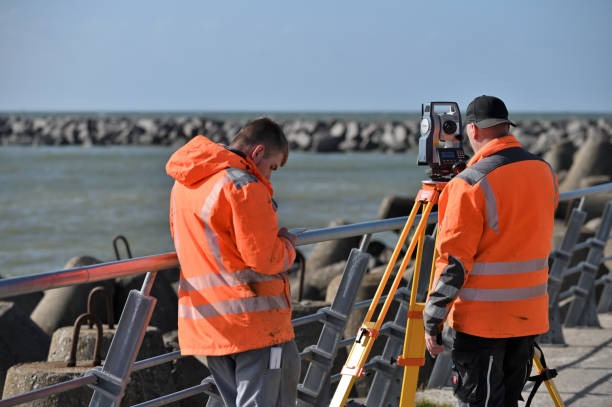
- Field Survey
A survey vessel moves across the water in planned lines. The sonar system collects data from depth. GPS tools record exact position. Motion sensors help correct boat movement from waves.
- Data Processing
The raw data needs cleanup. The team removes noise, checks tide levels, reviews sonar readings, and builds a final surface model.
- Final Deliverables
You get files and maps for planning. These might include bathymetric charts, 3D seabed models, CAD files, GIS files, volume reports, and written notes.

Key Tools Used in Hydrographic Surveys
Survey teams use different tools based on water depth, site size, and detail level needed.
Multibeam Sonar
Multibeam sonar sends many sound beams at once. It covers wide areas and gives dense data. This tool works well for detailed seabed mapping, dredging checks, and port work.
Single Beam Sonar
Single beam sonar measures one point below the boat at a time. It suits smaller jobs, simple depth checks, and budget-focused projects.
GNSS Positioning
GNSS gives accurate location data. It links each depth point to a real position on earth.
Motion Sensors
Boats move with waves. Motion sensors correct roll, pitch, and heave. This improves the survey results.
Tide and Water Level Data
Water levels rise and fall. Tide correction helps show true depth in relation to a set level.
What Makes a Good Hydrographic Survey Company?
You need more than a boat and a sonar. You need a team with field skills, clean processing methods, and clear reporting. Reliable hydrographic survey companies explain the data in plain language and help you use it for your project.
A good company should offer:
- Clear survey planning
- Modern sonar equipment
- Accurate positioning tools
- Safe field operations
- Clean data checks
- Useful maps and files
- Simple reports for project teams
- Support after delivery
For many BC marine projects, Hydrographic Survey Services British Columbia supports better decisions from the first planning step. You get facts, not rough guesses.
Common Problems a Survey Helps Solve
Many marine delays started because the underwater area was not checked well. A survey helps reduce this risk.
Unknown Water Depth
A vessel or barge needs enough clearance. Survey data shows safe depth and shallow zones.
Dredging Errors
Dredging needs accurate volume data. A hydrographic survey shows how much material needs removal and where.
Hidden Obstructions
Old piles, rocks, debris, and pipes create risk. Survey work helps locate these items before equipment arrives.
Poor Construction Planning
Marine contractors need clear site data. Better maps help them plan equipment, access, and work steps.
Environmental Concerns
Coastal teams need to understand seabed shape and sediment zones. This helps support reports and permit work.
Example of Practical Use
Say a marina owner wants to expand a dock area. The owner needs to know the water depth near the planned dock. A survey boat collects depth data across the site. The report shows shallow spots near one side and a deeper channel near another side.
With this data, the owner changes the dock layout. The contractor avoids extra dredging. The project saves time. The design also gives boats safer movement space.
This simple example shows why survey data matters. It helps you act before mistakes become expensive.
What You Should Ask Before Hiring
Before you choose a survey partner, ask clear questions. This helps you avoid weak data and unclear reports.
- What sonar system will you use?
- How accurate is the data?
- What files will I receive?
- Do you provide CAD or GIS formats?
- How do you correct tide levels?
- Do you handle shallow water work?
- Do you support construction teams?
- Do you explain the report after delivery?
Final Thoughts
Hydrographic survey work gives you a clear look under the water. It helps you plan marine work with less guesswork. You see depth, seabed shape, hazards, and site limits before major work starts.
For British Columbia projects, this data matters because each coastal and inland water site is different. A reliable survey helps your team protect budgets, improve safety, and build with better information. If your project touches water, start with accurate underwater mapping.
FAQ
- What are Hydrographic Survey Services British Columbia?
Hydrographic Survey Services British Columbia measure water depth and map underwater areas across BC. These services help with ports, docks, dredging, marine construction, and coastal studies.
- Why do I need a hydrographic survey?
You need a survey to understand what sits under the water. It shows depth, seabed shape, hazards, and safe work areas before your project begins.
- What tools do hydrographic survey companies use?
Most teams use sonar, GNSS positioning, motion sensors, tide data, and survey software. The exact setup depends on the site and project goal.
- What do I receive after a hydrographic survey?
You receive maps, charts, data files, 3D seabed models, volume reports, or CAD and GIS files based on your project needs.
- Who uses hydrographic surveys in British Columbia?
Ports, marina owners, engineers, contractors, dredging teams, environmental teams, government groups, and coastal property owners use these surveys for safer planning.